
Addressing the Core Challenges of Modern Mineral Exploration
Mineral exploration programs often need to balance field efficiency, target definition, data management, and the practical constraints of complex terrain. Single-method or disconnected workflows can make it harder to organize survey data, compare results across survey lines, and decide where follow-up geological mapping, trenching, or drilling should be prioritized.
Geomative Co., Ltd. provides geophysical equipment and related digital tools under its “Geophysics+” concept. Its portfolio includes electrical resistivity and induced-polarization systems, magnetic-survey instruments, transient electromagnetic systems, field power supplies, and online-monitoring solutions.
For mineral exploration teams, the value of an integrated approach is not that one instrument confirms an orebody independently. Rather, it is that complementary methods can provide different types of subsurface evidence to support geological interpretation and follow-up verification.
Electrical Resistivity and IP for Subsurface Investigation
GD-10: Single-Channel Electrical Surveying
The GD-10 is a single-channel electrical resistivity and induced-polarization system. Depending on the selected model and configuration, it can support electrical sounding as well as 2D and 3D resistivity or IP survey tasks.
Its sectional centralized survey layout combines aspects of conventional centralized and distributed cabling. Features such as custom survey scripts, automated stacking, and field data display can support flexible deployment and data-quality review in varied field conditions.
For mineral exploration, resistivity and IP data can help identify electrical contrasts associated with geological structures, alteration zones, fractures, and mineralization-related anomalies. Such anomalies require correlation with geological mapping, geochemical information, drilling, and assay data before resource conclusions are made.
GD-20: Multichannel Field-Testing Efficiency
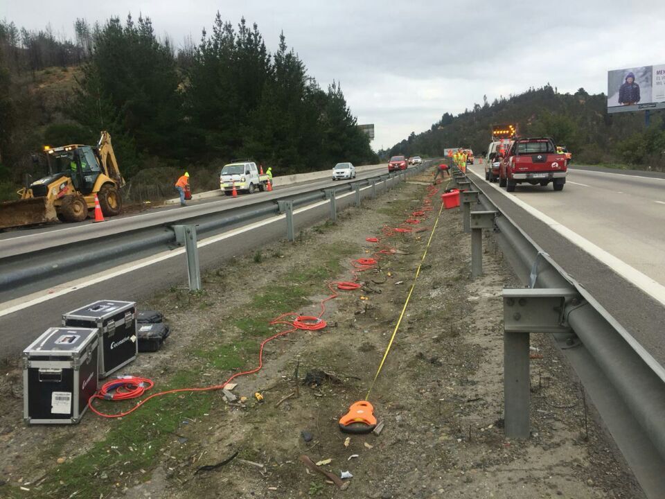
The GD-20 is a multi-channel electrical resistivity and IP system designed for projects involving multiple survey lines, broader areas, or tighter field schedules.
The system uses an independent 5/12-channel design. Depending on survey mode and configuration, it can support up to 10 ERT acquisition channels and up to 12 sounding points. Geomative states that its average field-testing efficiency can be 2–3 times that of single-channel equipment under comparable conditions.
The GD-20 supports self-potential, apparent-resistivity, and IP testing, along with relevant 2D, 3D, and pseudo-3D survey arrangements according to configuration. Its high-power IP mid-gradient profiling workflow uses ERT modules for automated, sequential electrode selection during acquisition.
The 2–3× figure refers to average field-testing efficiency. It does not guarantee higher exploration accuracy, lower drilling cost, or successful mineral discovery.
Magnetic Surveying for Magnetically Responsive Targets
Magnetic surveying can complement resistivity and IP methods where target geology produces measurable magnetic contrasts.
Geomative’s GPM-10 proton magnetometer uses an OCXO for time stability and supports GNSS, GPS, BeiDou, and GLONASS positioning and time synchronization. It can be used to collect total-field or gradient magnetic data for the interpretation of magnetic anomalies.
The instrument is relevant to mineral exploration involving magnetically responsive ore bodies and geological structures, including iron, lead-zinc, and copper exploration applications listed by Geomative. Magnetic data should be interpreted in the context of local geology; not all mineral deposits, including all gold targets, necessarily produce a diagnostic magnetic anomaly.
TEM for Middle- and Deep-Range Investigation
For exploration programs requiring transient electromagnetic methods, Geomative offers the GT-10 Mineral TEM system.
The GT-10 integrates the receiver, transmitter, and power supply into a portable “one-box” design, helping simplify field transport and deployment. Geomative lists the GT-10 for mineral, groundwater, geological-structure, and middle- to deep-range exploration applications.
The product page states a detection range of 30–1300m. Actual depth of investigation depends on geological conditions, target conductivity contrast, survey design, noise conditions, terrain, and field parameters. This stated range belongs to the GT-10 TEM system; it should not be presented as the depth capability of GD-series resistivity systems or GP5000 power equipment.
Selecting Field Power for Survey Requirements
Reliable field power is an important operational consideration for resistivity and IP surveys. Geomative’s power-supply portfolio includes BP-series DC power sources and the GP-5000 high-power rectifier.
The GP-5000 converts 220V AC input into continuously adjustable 0–1000V DC output, with a maximum output current of 5A and maximum output power of 5kW. It can be evaluated for high-power applications where site power and measurement-system compatibility allow.
Power selection should be based on the selected instrument, transmitter circuit, electrode layout, target depth, ground resistance, field safety requirements, and available site power. Higher power alone does not determine survey depth, data quality, or exploration success.
Data Workflows and Online Monitoring
Geomative Studio supports electrical-survey workflow functions such as array configuration and survey-script preparation before field deployment. Survey data can then be transferred into appropriate processing and interpretation workflows.
According to Geomative’s latest product information, DIGspace Geo-3D Platform is the current name for the company’s digital data-platform direction. Its published online monitoring framework includes field monitoring equipment, communications, cloud data transmission, data display, and configurable alert functions.
For mineral operations, online monitoring is most relevant to environmental and infrastructure-management needs that may accompany extraction activities—for example, tailings-facility monitoring, dam safety, groundwater migration, or slope-related observation. It can support continuous data collection and remote review, but it does not replace on-site inspection, engineering assessment, or verification of abnormal readings.
Evidence and Research Context
Geomative has published application cases across groundwater investigation, environmental investigation, engineering exploration, archaeology, and mineral-survey contexts. These cases demonstrate the use of geophysical methods in varied field settings, but each result remains specific to the local geology, survey design, and verification evidence available for that project.
The company has also stated that it led the development of a “Subsurface Environmental Spatial Information Management System for Contaminated Sites” under a National Key R&D Program. Its company history records a national invention patent for the “Segmented Centralized High-Density Electrical Method System and Its Application.”
Geomative’s website states that its products and solutions are used in more than 40 countries and regions, across 100+ industry applications, and by more than 1,000 clients worldwide.
Conclusion
Integrated geophysical solutions can help mineral exploration teams combine complementary sources of evidence: resistivity and IP data for electrical-property mapping, magnetic data for magnetically responsive structures, TEM for relevant electromagnetic investigation, suitable power arrangements for field deployment, and digital workflows for data organization.
Geomative’s GD-10, GD-20, GPM-10, GT-10, power-supply portfolio, Geomative Studio, and DIGspace Geo-3D Platform can be evaluated as components of such a workflow. The appropriate combination should be selected according to target geology, survey scale, terrain, required depth of investigation, budget, available power, and—most importantly—the planned geological and drilling verification process.
https://www.geomative.com
Geomative Co., Ltd.
About Author

You may also like
-
Sustainability in the LED Rental Display Industry
-
How to Choose the Right Pulley for Industrial Power Transmission
-
How to Design a Reliable Vacuum Solution: Pump Selection and Evacuation Time
-
FC Front End Telescopic Cylinder Specifications and Price: How to Choose the Right Cylinder for Heavy-Duty Dump Trucks
-
How Energy Saving Passenger Elevators Reduce Building Operating Costs